Some of the Advanced Solutions we develop
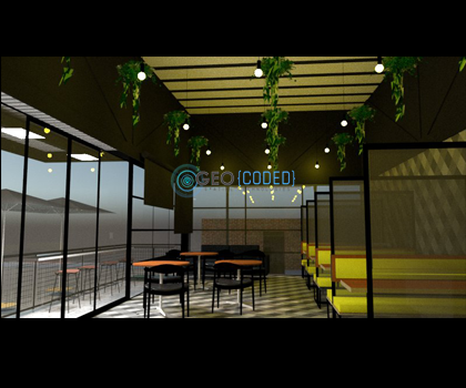
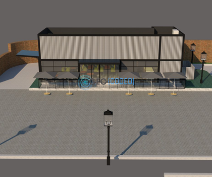
Geographic Information Systems | CAD designs | LiDAR Scanning | Indoor Mapping | As-Built Floor Layouts | Scan to BIM | 3D Models | 360° Virtual Tours | Full Stack Software Development | Mobile Applications Development | Web Applications Development | Asset Management Systems Development | Pavement Management Systems | Project Management | Virtual Reality | Augmented Reality | Mapping Design | Database Design and Administration | Training.
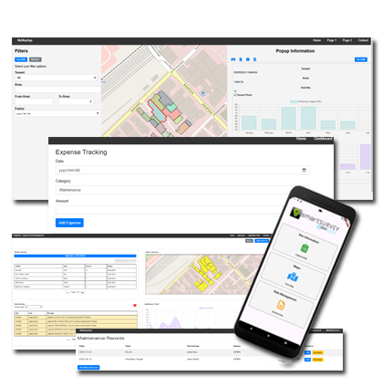
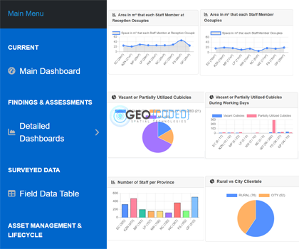
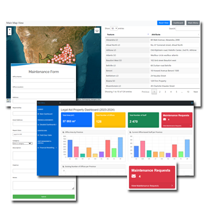
Comprehensive Mall & Property Management Software
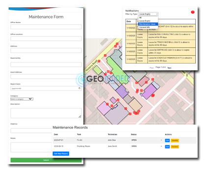
Maintenance & Monitoring Software with live or near live data feed
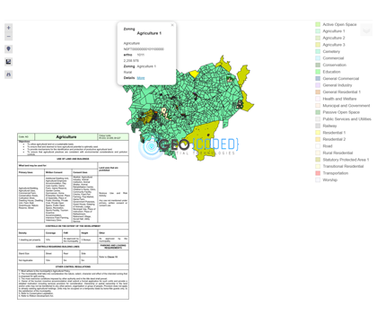
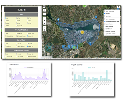
Facilities Management Interactive Web based Map
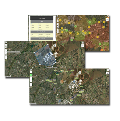
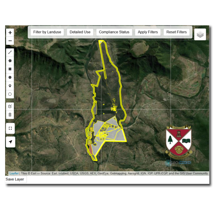
Web Map with advanced GIS based features and Mobile integration
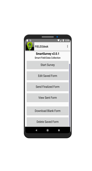
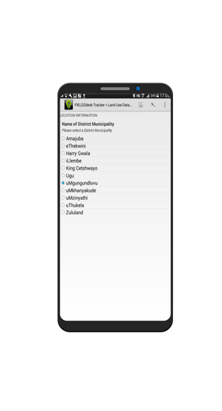
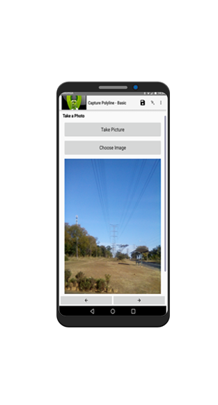
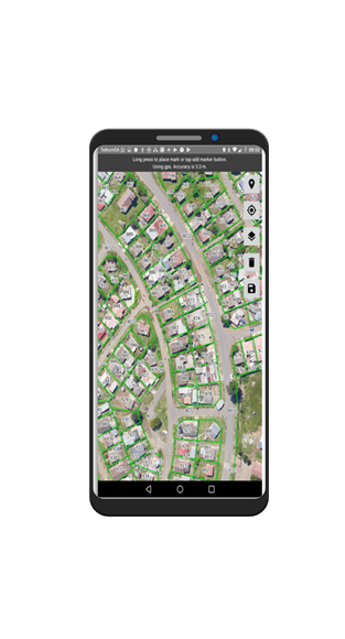
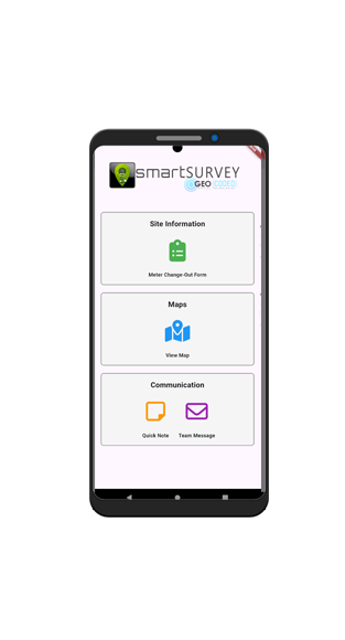
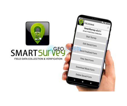
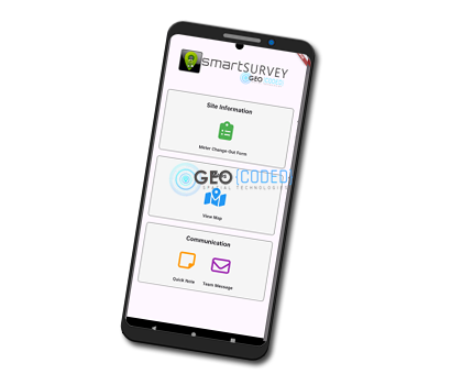
SmartSurvey: Field2DESK is a powerful mobile application designed for seamless data collection, enabling users to capture information through custom-built forms tailored to specific needs. Fully operational offline, the app ensures flexibility and reliability in remote environments, with features for GPS tagging, multimedia capture, and secure data syncing when back online.
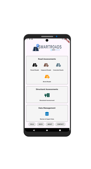
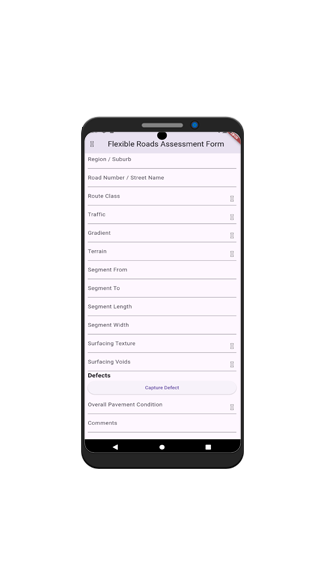
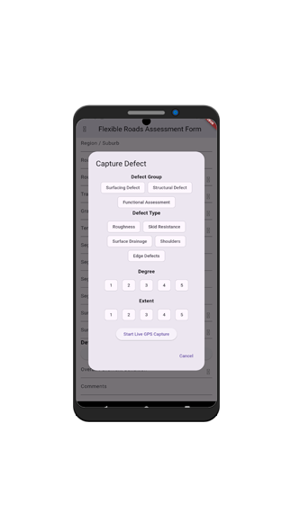
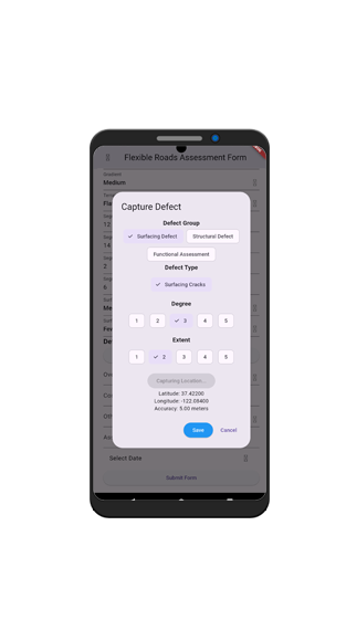
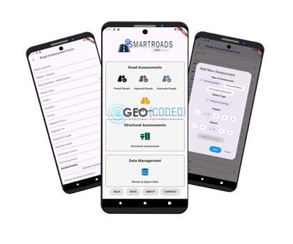
SmartRoads is a comprehensive mobile application designed for Road Defect Assessments across Paved, Unpaved, Concrete, and Block road surfaces, as well as to assess defects and current condition of Structures. Fully compliant with TMH 9 and TMH 18 standards, it streamlines data collection and analysis to support efficient road maintenance and management.
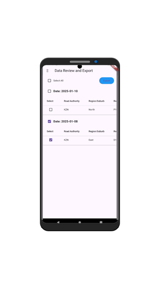
SmartSurvey: WaterMeters is a form-based app designed to capture water meter positions, repair types, and current conditions. It streamlines communication between site teams and office management while enabling live team tracking and management through an interactive map.